Category
Homewares Art
Store
TROUVA
Brand
Jenni Sparks
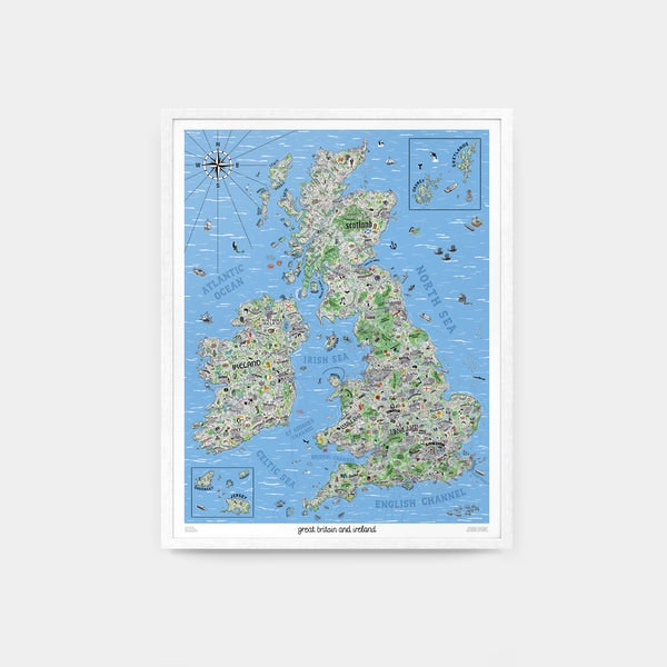
Hand Drawn Map of Great Britain and Ireland by Jenni Sparks. 24" x 30" / 60.1cm x 76.2cm. For the first time, illustrator Jenni Sparks has mapped out England, Scotland, Wales and Ireland with her Hand Drawn Map of Great Britain and Ireland. Distilling the quirks and culture of Britain and Ireland with playful graphics, this map takes an in-depth tour of its many towns and cities. It dives into historic sites, like the Long Man of Wilmington, and legendary local landmarks, like Manchesters Haçienda, handily organising areas around motorway and ferry routes. The map derives from countless hours of research, trips, and tips from locals from across the Great Britain and Ireland. Compiling sports team rivalries, foodie destinations and strange folklore, Jenni has turned her findings into a stunning art print. Her artwork creates the definitive companion guide for a journey across Great Britain and Ireland, tapping into the personality behind its many faces and places with effortless hum
168.49 USD
Recommendations
Choose your language and region
Klarna is available around the world with a variable offering, choose one that suits you best.
Copyright © 2005-2024 Klarna Bank AB (publ). Headquarters: Stockholm, Sweden. All rights reserved. Klarna Bank AB (publ). Sveavägen 46, 111 34 Stockholm. Organization number: 556737-0431